Cactus
Canyon Campground
And Resort, LLC
The Largest campground for men in the world!
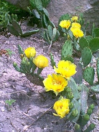
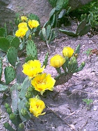
A naturalist's paradise in the Ozarks
Rated as the #1 men's nudist places in the USA
|
Cactus
Canyon Campground
And Resort, LLC |
|
The Largest campground for men in the world! |
||
A naturalist's paradise in the Ozarks |
||
Rated as the #1 men's nudist places in the USA |
||
Directions |
| Cactus Canyon Campground is located in the heart of the Ozarks in Ava, Missouri. Pick from the list below the area which you are coming from: Kansas City, Tulsa, Springfield, St. Louis, Branson, Mt. Home, Memphis, Columbia/ Jefferson City or are needing the back entrance directions in case the creek has flooded. If you are using a GPS device, the coordinates to the campground are W36 53' 47.72 N 92 29' 15.62 |
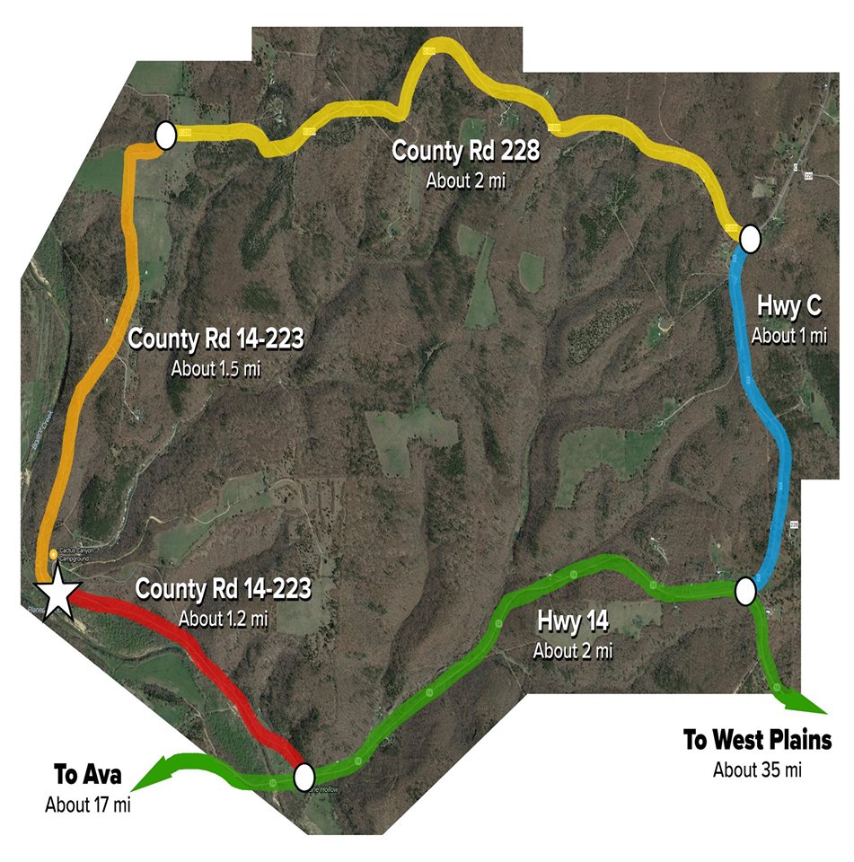
If you are coming in from the Kansas City area, take Hwy 7 south to Hwy 13 south to Springfield. Then travel east on Interstate 44 to Hwy 65 south to Branson. On the south side of Springfield, pick up Hwy 60 east. Now use the Springfield directions below. TOP If you are coming in from the Tulsa area, take I-44 east to Hwy 60 east, exit 69 and pick up the directions from Springfield below. TOP If you are coming in from Springfield, take Hwy 60 east 42 miles to Hwy 5 south in Mansfield. Then travel south for 12 miles until you reach Ava. At the light, turn left onto Hwy 14 and follow it to the square. You will travel 3/4 around the square and continue on Hwy 14 east. From the square in Ava take Hwy 14 east for 16 miles until you cross Bryant Creek. You will see a sign for New Haven Event Park on the right, and a gravel road (14-223) on the left. Turn left on the gravel road and go 1.2 miles up the road, pass 1 house at the beginning of the gravel road, along side a creek to the entrance of the campground, marked with a sign. Turn right at the sign and come up to the registration. You will only see 1 home on the road before our drive. TOP If you are coming from the St. Louis area, take I-44 west to Rolla about 102 miles then take US 63/I-44 Loop/MO 72 exit, exit number 186, towards Rolla/Jefferson City. Turn left onto I-44 Loop. I-44 loop becomes US 63 south. Stay on US 63 south for about 65 miles until you come to the town of Cabool stay on business route 63 to the US 60 west ramp and travel about 18 miles to the town of Norwood and take the MO-C/MO-E ramp, then turn left onto MO-C and travel approx. 17 miles to a "T" at MO-C and Hwy 14. Turn right onto Hwy 14 and travel 2 miles until you see the sign for New Horizons Event Park on the left, and a gravel road (14-223) on the right. Turn right on the gravel road and go 1.2 miles up the road, pass 1 houses at the beginning of the gravel road, along side a creek to the entrance of the campground, marked with a sign. Turn right at the sign and come up to the registration. You will only see 1 home on the road before our drive. TOP If you are coming in from the Branson area, Take hwy 76 east to the four way stop sign at hwy 76 and hwy 5. Go straight through the stop sign to the town square in downtown Ava. follow signs for Hwy 14 East; then follow hwy 14 east for 16 miles until you cross Bryant Creek. You will see a sign for New Horizons Event Park on the right, and a gravel road (14-223) on the left. Turn left on the gravel road and go 1.2 miles up the road, pass 1 house at the beginning of the gravel road, along side a creek to the entrance of the campground, marked with a sign. Turn right at the sign and come up to the registration. You will only see 1 home on the road before our drive. TOP If you are coming in from the Mt. Home, Arkansas area, take Hwy 5 north, pass through Gainesville and continue north to Hwy N to Rockbridge. Follow Hwy N east for approx. 2 miles to Hwy P, turn left and continue to Hwy 14. Turn right onto Hwy 14 and continue on Hwy 14 approx. 4 miles until you cross the Bryant Creek . You will see a sign for New Haven Event Park on the right, and a gravel road (14-223) on the left. Turn left on the gravel road and go 1.2 miles up the road, pass 1 house at the beginning of the gravel road, along side a creek to the entrance of the campground, marked with a sign. Turn right at the sign and come up to the registration. You will only see 1 homes on the road before our drive. TOP If you are coming in from the Memphis area, take I-55 north to Hwy 63 North. Stay on Hwy 63 to West Plains, Missouri. Turn Left t onto hwy 14 going west. You will travel approx. 35 miles to the junction of Hwy MO-C and Hwy 76. Staying on Hwy 14, follow hwy 14 for another 2 miles until you see the sign for New Haven Event Park on the left, and a gravel road (14-223) on the right. Turn right on the gravel road and go 1.2 miles up the road, pass 3 houses at the beginning of the gravel road, along side a creek to the entrance of the campground, marked with a sign. Turn right at the sign and come up to the registration. You will only see 3 homes on the road before our drive. TOP If you are coming in from Columbia/Jefferson City area, the following directions begin at Columbia. So if you are coming in from Jefferson City pick up the directions at the appropriate spot. Take US-63 south for 26 miles then merge onto US-54 west at Jefferson City and travel for 60 miles and turn left onto MO-5/MO-7 south. Continue to follow MO-5 south for 24.5 miles then turn left onto MO-5 south/MO-64/N Jefferson Ave. Continue to follow MO-5 south for 47 miles this will take you to US - 60. Merge onto US-60 west/MO-5 south for 1 mile and get off on the MO-5 south/MO-EE/MO-F ramp toward MO-B/Mansfield/Ava. Turn left onto MO-5 south and travel 12 miles to the stop light in Ava turn left onto Hwy 14 east and follow it to the square. You will travel 3/4 around the square and continue on Hwy 14 east. From the square in Ava take Hwy 14 east for 16 miles until you cross Bryant Creek. You will see a sign for New Haven Event Park on the right, and a gravel road (14-223) on the left. Turn left on the gravel road and go 1.2 miles up the road, pass 1 house at the beginning of the gravel road, along side a creek to the entrance of the campground, marked with a sign. Turn right at the sign and come up to the registration. You will only see home on the road before our drive. TOP At times during inclement weather, the Bryant Creek has been known to cover County 223. If you have questions about this condition, please call us. Otherwise, you may use the back way in to Cactus Canyon Campground. Go east from the intersection of City 223 and Hwy 14 for 2 miles. Turn left onto Hwy MO-C. Go one mile just up the hill about a block and on the left, there is an old cabin and a gravel road, (City 228) turn left there and go the 3 miles down the road to the "T" intersection and turn left and go the half mile to the entrance of the campground. This road is generally well kept. Expect that the road narrows to a one lane road the last 1/4 mile. Map below. We are easily found on Google Maps, I caution however, that you see that you come in off HWY 14 only. The reason is that Google might take you down the back roads of gravel otherwise. |
 |